
 Welcome to the Digital Scholarship GIS Guide.
The purpose of this guide is to recommend journal article databases, books, data sources, methods and other materials for conducting research using spatial analysis and Geographic Information Systems (GIS). Click on the tabs at the top of the page to navigate among the sections of this guide to discover useful resources. Need help? Ask a Librarian!
 What is GIS?
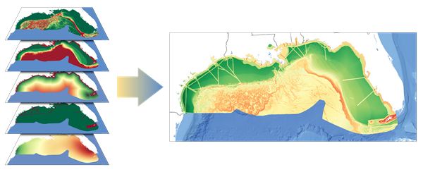
A geographic information system (GIS) lets us visualize, question, analyze, and interpret data to understand relationships, patterns, and trends.
Definition from GISLounge, ESRI (examples)
GIS Poster from USGS
Check out The ArcGIS Book (interactive pdf)

Visit the the NUS and Yale-NUS Library Libguides for compilations of global, regional, and local data, statistics and spatial data sources (see first and second links below).

For the graduate programme of Master of Science in Applied GIS hosted in Department of Geography at NUS, please refer to this link for more information on the admission requirements, programme structure, tracks of training, fees and contact details.
RSS Feed from GIS Lounge:
RSS Feed from Flowing Data